
Nasa on Friday released high-resolution images captured by its Lunar Reconnaissance Orbiter Camera (LROC) during its flyby of the lunar region where India’s ambitious Chandrayaan 2 mission attempted a soft landing near the Moon’s uncharted south pole and found Vikram had a hard landing.
HIGHLIGHTS:
- Nasa has confirmed that Chandrayaan 2 lander Vikram had hard landing on Moon surface
- According to Nasa, Vikram’s precise location is yet to be determined
- The scene was captured from the camera of Nasa’s Lunar Reconnaissance Orbiter
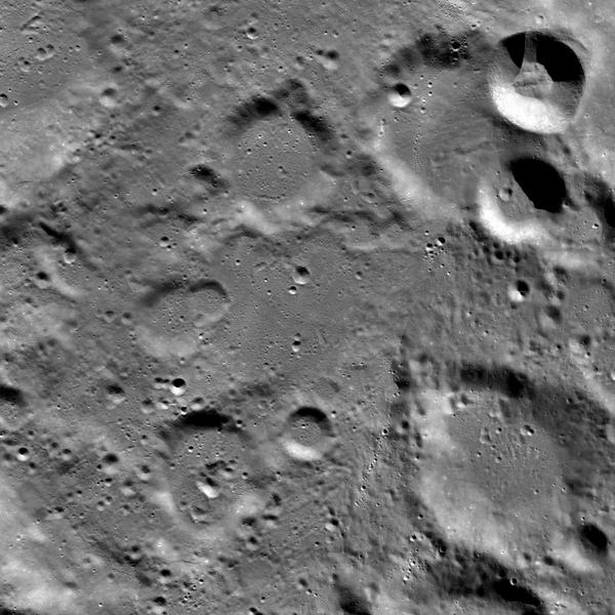
While the window on contact with Chandrayaan 2 lander Vikram has set, we have now obtained new images that give may clue to what may have happened to the lander, courtesy Nasa.
Nasa on Friday released high-resolution images captured by its Lunar Reconnaissance Orbiter Camera (LROC) during its flyby of the lunar region where India’s ambitious Chandrayaan 2 mission attempted a soft landing near the Moon’s uncharted south pole and found Vikram had a hard landing.
The module had attempted a soft landing on a small patch of lunar highland smooth plains between Simpelius N and Manzinus C craters before losing communication with ISRO on September 7. The site was about 600 km from the south pole in a relatively ancient terrain, according to the US space agency.
“Vikram had a hard landing and the precise location of the spacecraft in the lunar highlands has yet to be determined, Nasa said.
It is possible that the Vikram lander is hiding in a shadow. The lighting will be favourable when LRO passes over the site in October and once again attempts to locate and image the lander.
This was the reconfirmation that Indian Space Research Organisation and the space community have awaited to figure out where and how the lander of the Chandrayaan-2 mission had fallen when it attempted to touch down on the moon.
The LRO, orbiting moon since September 2009, has a camera with 50-cm high resolution and goes around in an eccentric orbit of 20 km x 165 km.
The remaining Indian orbiting module has a camera with a 30-cm resolution. ISRO already has pictures sent by it from its 100-km height soon after the landing failed.
The landing region lies between two craters about 70° south of the lunar equator and about 600 km from its shadowy south pole.
The orbiting Chandrayaan-2 and the LRO routinely fly over the same spot at regular intervals. Images from their next flyovers could help ISRO give conclusive information, Indian experts said earlier.
ISRO on September 7 only said that it lost signal contact from a descending lander merely three minutes and 2.1 km before its scheduled soft-landing on the lunar surface. A team of experts is analysing the crash landing, it recently said.